ZCZC MIATWOEP ALL
TTAA00 KNHC DDHHMM
Tropical Weather Outlook
NWS National Hurricane Center Miami FL
500 AM PDT Sun Jul 15 2018
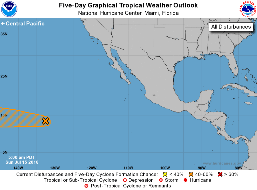
For the eastern North Pacific...east of 140 degrees west longitude:
1. Shower and thunderstorm activity has changed little during the
past several hours in association with a low pressure system located
about 1500 miles east-southeast of the Hawaiian Islands.
Environmental conditions are expected to gradually become more
conducive for development, and a tropical depression could form
during the next few days while the system moves westward. This
system is expected to cross into the Central Pacific basin by early
Monday.
* Formation chance through 48 hours...medium...40 percent.
* Formation chance through 5 days...medium...60 percent.
Forecaster Cangialosi