Skip Navigation Links
NOAA NOAA United States Department of Commerce

NHC Graphical Outlook Archive


« Earliest Available         ‹ Earlier         Later ›         Latest Available »
GIS Shapefiles
tab Eastern North Pacific tab tab Atlantic tab

View 2-Day Graphical Tropical Weather Outlook
Click for Atlantic Click for Atlantic

Tropical Weather Outlook Text

ZCZC MIATWOEP ALL
TTAA00 KNHC DDHHMM

Tropical Weather Outlook
NWS National Hurricane Center Miami FL
500 PM PDT Tue Jul 10 2018

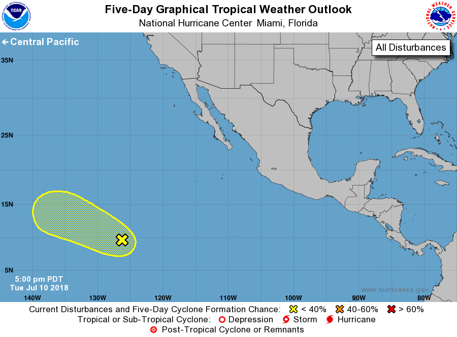
For the eastern North Pacific...east of 140 degrees west longitude:

1. A broad trough of low pressure located about 1400 miles southwest of
the southern tip of the Baja California peninsula is producing
disorganized showers and a few thunderstorms.  Environmental
conditions appear marginally conducive for some development during
the next few days while the system moves west-northwestward at
about 10 mph.
* Formation chance through 48 hours...low...10 percent
* Formation chance through 5 days...low...20 percent

Forecaster Berg


List of Atlantic Outlooks (May 2023 - present)
List of East Pacific Outlooks (May 2023 - present)
List of Central Pacific Outlooks (May 2023 - present)
List of Atlantic Outlooks (July 2014 - April 2023)
List of East Pacific Outlooks (July 2014 - April 2023)
List of Central Pacific Outlooks (June 2019 - April 2023)
List of Atlantic Outlooks (June 2009 - June 2014)
List of East Pacific Outlooks (June 2009 - June 2014)