ZCZC MIATWOEP ALL
TTAA00 KNHC DDHHMM
Tropical Weather Outlook
NWS National Hurricane Center Miami FL
500 AM PDT Wed Jun 27 2018
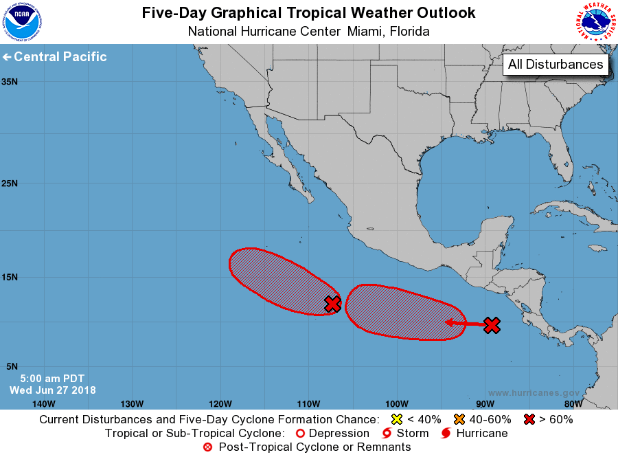
For the eastern North Pacific...east of 140 degrees west longitude:
1. Cloudiness and showers associated with a broad low pressure area
located about 600 miles south of Manzanillo, Mexico, continue to
gradually become better organized. Environmental conditions
support further development, and a tropical depression is expected
to form within the next day or so while the system moves generally
west-northwestward away from Mexico.
* Formation chance through 48 hours...high...90 percent.
* Formation chance through 5 days...high...near 100 percent.
2. Disorganized showers and thunderstorms over the far eastern
Pacific Ocean are associated with a westward-moving tropical wave.
Environmental conditions are forecast to be conducive for gradual
development of this system over the next several days, and a
tropical depression is expected to form well south of the coast of
Mexico over the weekend.
* Formation chance through 48 hours...low...30 percent.
* Formation chance through 5 days...high...90 percent.
Forecaster Blake