ZCZC MIATWOEP ALL
TTAA00 KNHC DDHHMM
Tropical Weather Outlook
NWS National Hurricane Center Miami FL
500 AM PDT Fri Jun 22 2018
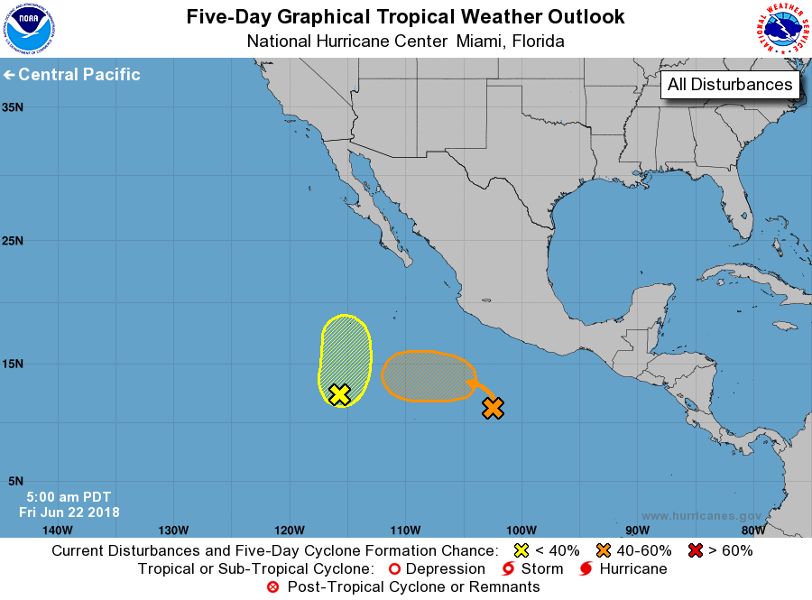
For the eastern North Pacific...east of 140 degrees west longitude:
1. A tropical wave located several hundred miles south-southwest of
Acapulco, Mexico, is producing a large area of disorganized showers
and a few thunderstorms. An area of low pressure is expected to
form from this system over the next day or two, and a tropical
depression could form early next week while the disturbance moves
westward to west-northwestward at 5 to 10 mph away from the coast of
Mexico.
* Formation chance through 48 hours...low...10 percent.
* Formation chance through 5 days...medium...50 percent.
2. A broad area of low pressure located about 800 miles south-southwest
of the southern tip of the Baja California peninsula is producing
disorganized shower activity. Environmental conditions are expected
to be marginally conducive for development over the next few days
while the disturbance moves toward the north or north-northeast at
about 5 mph over the open eastern North Pacific.
* Formation chance through 48 hours...low...20 percent
* Formation chance through 5 days...low...30 percent
Forecaster Berg