ZCZC MIATWOEP ALL
TTAA00 KNHC DDHHMM
Tropical Weather Outlook
NWS National Hurricane Center Miami FL
1100 AM PDT Thu Jun 14 2018
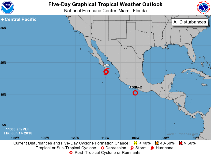
For the eastern North Pacific...east of 140 degrees west longitude:
The National Hurricane Center is issuing advisories on Tropical
Storm Bud, located just south of the southern tip of the Baja
California peninsula.
1. Satellite images indicate that an area of low pressure centered
about 120 miles south of Acapulco, Mexico, is becoming better
defined, and a tropical depression could be forming. If current
trends continue, advisories will be initiated this afternoon or
evening on this system. The low is expected to move slowly
northwestward near or over the coast of Mexico during the next
couple of days. The system is forecast to produce heavy rains, with
flash floods and mudslides likely over the southern portions of the
Mexican states of Guerrero and Oaxaca through the weekend.
* Formation chance through 48 hours...high...90 percent.
* Formation chance through 5 days...high...90 percent.
Forecaster Blake