ZCZC MIATWOEP ALL
TTAA00 KNHC DDHHMM
Tropical Weather Outlook
NWS National Hurricane Center Miami FL
500 AM PDT Thu Jun 14 2018
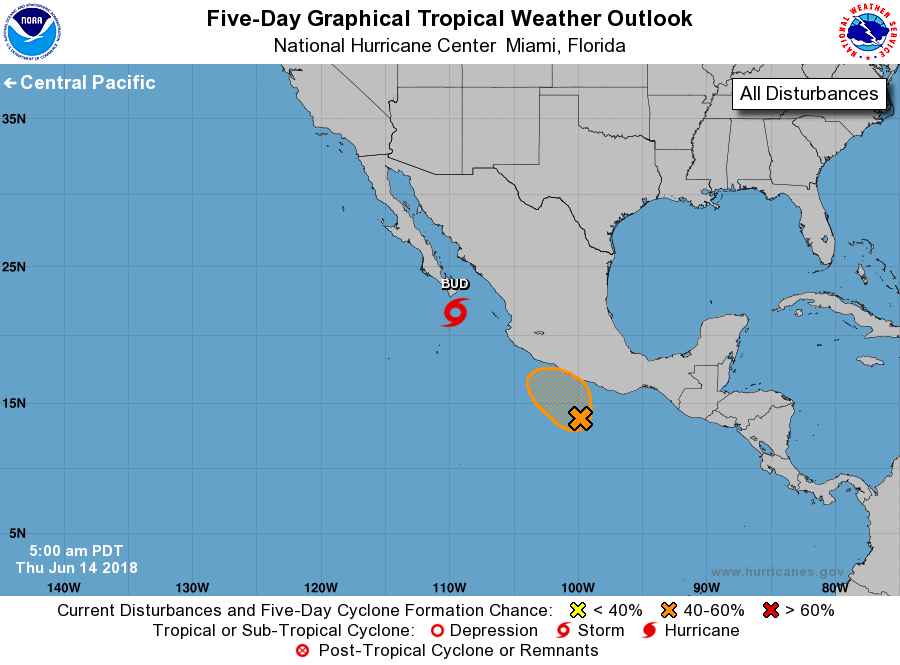
For the eastern North Pacific...east of 140 degrees west longitude:
The National Hurricane Center is issuing advisories on Tropical
Storm Bud, located about a hundred miles south-southeast of the
southern tip of the Baja California peninsula.
1. A low pressure system located a couple of hundred miles south of
Acapulco, Mexico, continues to produce disorganized showers and
thunderstorms. Environmental conditions are forecast to be somewhat
conducive for additional development, and a tropical depression
could form over the next day or so while the low moves slowly
northwestward near or over the coast of Mexico. Regardless of
development, locally heavy rain causing flash floods and mudslides
is likely over the southern portions of the Mexican states of
Guerrero and Oaxaca through the weekend. Potential tropical cyclone
advisories could be initiated on this system later today.
* Formation chance through 48 hours...medium...60 percent.
* Formation chance through 5 days...medium...60 percent.
Forecaster Blake