ZCZC MIATWOEP ALL
TTAA00 KNHC DDHHMM
Tropical Weather Outlook
NWS National Hurricane Center Miami FL
1100 PM PDT Tue Jun 5 2018
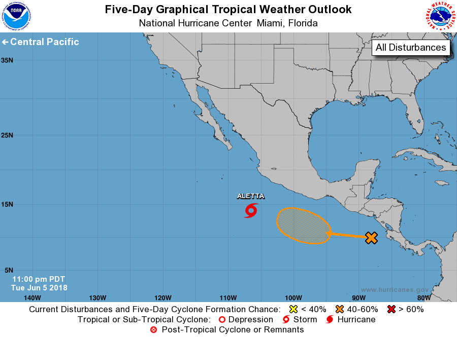
For the eastern North Pacific...east of 140 degrees west longitude:
The National Hurricane Center is issuing advisories on newly formed
Tropical Depression Two-E located several hundred miles south-
southwest of Manzanillo Mexico.
1. A tropical wave in the far eastern Pacific Ocean is producing
disorganized showers and thunderstorms. Upper-level winds are
forecast to gradually become more conducive for development during
the next several days, and a tropical depression could form over the
weekend while the system moves westward to west-northwestward off
the coast of southern Mexico.
* Formation chance through 48 hours...low...10 percent.
* Formation chance through 5 days...medium...60 percent.
Public Advisories on Tropical Depression Two-E are issued under
WMO header WTPZ32 KNHC and under AWIPS header MIATCPEP2.
Forecast/Advisories are issued under WMO header WTPZ22 KNHC
and under AWIPS header MIATCMEP2.
Forecaster Avila