ZCZC MIATWOEP ALL
TTAA00 KNHC DDHHMM CCA
Special Tropical Weather Outlook...Corrected
NWS National Hurricane Center Miami FL
1040 AM PDT Thu May 10 2018
Correction to change Thursday to Friday in the time of the next
outlook issuance
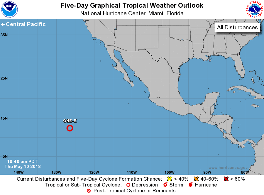
For the eastern North Pacific...east of 140 degrees west longitude:
1. Although the shower activity associated with the broad area of low
pressure located about 1300 miles southwest of the southern tip of
the Baja California peninsula has increased this morning, the
low-level circulation is elongated and remains poorly defined.
However, only a small increase in organization could lead to the
formation of a tropical depression later today or early Friday
before the upper-level winds become highly unfavorable for tropical
cyclone formation. This system should move slowly toward the
west-northwest or northwest during the next couple of days. Another
Special Tropical Weather Outlook on this disturbance will be issued
by 11 AM PDT on Friday.
* Formation chance through 48 hours...medium...50 percent.
* Formation chance through 5 days...medium...50 percent.
Forecaster Avila