ZCZC MIATWOEP ALL
TTAA00 KNHC DDHHMM
Tropical Weather Outlook
NWS National Hurricane Center Miami FL
400 AM PST Sun Nov 12 2017
For the eastern North Pacific...east of 140 degrees west longitude:
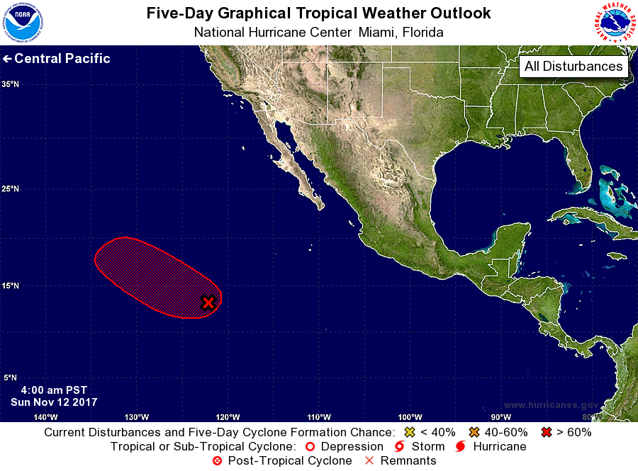
1. Satellite imagery indicates that shower activity associated with the
low pressure system located more than 1000 miles southwest of the
southern tip of the Baja California peninsula has changed little in
organization during the past several hours. Only a slight increase
in organization would result in the formation of a tropical
depression later today or tonight. By the middle of next week,
however, upper-level winds are expected become quite unfavorable for
tropical cyclone formation to occur. This system is forecast to move
west-northwestward to northwestward at 15 to 20 mph across the open
eastern Pacific during the next several days.
* Formation chance through 48 hours...high...70 percent.
* Formation chance through 5 days...high...70 percent.
Forecaster Beven