ZCZC MIATWOEP ALL
TTAA00 KNHC DDHHMM
Tropical Weather Outlook
NWS National Hurricane Center Miami FL
400 PM PST Sat Nov 11 2017
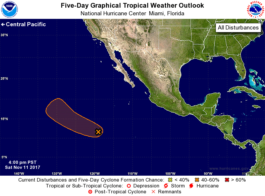
For the eastern North Pacific...east of 140 degrees west longitude:
1. Recent satellite-derived wind data indicate that the low pressure
system located about 1000 miles southwest of the southern tip of the
Baja California peninsula is gradually becoming better defined.
Shower and thunderstorm activity is also beginning to show some
signs of organization, and a tropical depression could form during
the next day or so if this recent development trend continues. By
the middle of next week, however, upper-level winds are expected
become quite unfavorable for tropical cyclone formation to occur.
This system is forecast to move west-northwestward to northwestward
across the open eastern Pacific during the next several days.
* Formation chance through 48 hours...medium...50 percent.
* Formation chance through 5 days...medium...50 percent.
Forecaster Stewart