ZCZC MIATWOEP ALL
TTAA00 KNHC DDHHMM
Tropical Weather Outlook
NWS National Hurricane Center Miami FL
400 PM PST Fri Nov 10 2017
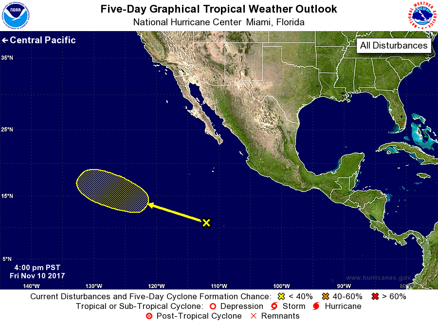
For the eastern North Pacific...east of 140 degrees west longitude:
1. A weak area of low pressure located about 800 miles south-southwest
of the southern tip of the Baja California peninsula is producing
disorganized shower activity. Little development is expected during
the next couple of days due to unfavorable environmental conditions,
but conditions could become a little more conducive early next week.
This system is expected to move west-northwestward across the open
eastern Pacific during the next several days.
* Formation chance through 48 hours...low...near 0 percent.
* Formation chance through 5 days...low...20 percent.
Forecaster Cangialosi