ZCZC MIATWOEP ALL
TTAA00 KNHC DDHHMM
Tropical Weather Outlook
NWS National Hurricane Center Miami FL
500 PM PDT Mon Oct 16 2017
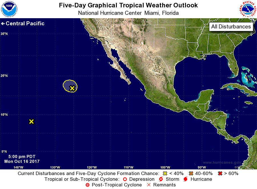
For the eastern North Pacific...east of 140 degrees west longitude:
1. Showers and thunderstorms associated with a low pressure area
located about a thousand miles west of the southern tip of the Baja
California peninsula have become significantly less organized since
this morning due to very strong upper-level winds. In addition,
the low has moved over colder waters, and development of this system
is becoming less likely while it moves northwestward at about 10
mph.
* Formation chance through 48 hours...low...30 percent.
* Formation chance through 5 days...low...30 percent.
2. Another low pressure area located about 1300 miles east-southeast
of the Hawaiian Islands is producing disorganized showers and a few
thunderstorms while moving west-northwestward at about 10 mph.
Development of this system is not expected due to increasing
upper-level winds and proximity of dry air.
* Formation chance through 48 hours...low...near 0 percent.
* Formation chance through 5 days...low...near 0 percent.
Forecaster Berg