ZCZC MIATWOEP ALL
TTAA00 KNHC DDHHMM
Tropical Weather Outlook
NWS National Hurricane Center Miami FL
1100 AM PDT Sun Oct 15 2017
For the eastern North Pacific...east of 140 degrees west longitude:
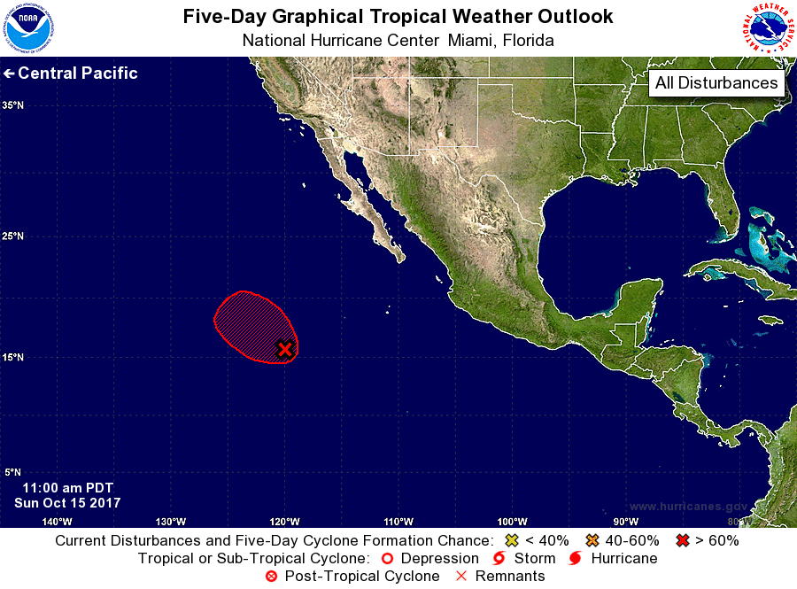
1. Satellite imagery indicates that the low pressure system located
several hundred miles southwest of the southern tip of the Baja
California peninsula has not become any better organized since
yesterday. However, environmental conditions are still expected to
be conducive for a tropical depression to form through tomorrow
morning. After that time, cool waters and strong upper-level winds
are likely to prevent further development while the system moves
toward the west-northwest or northwest at 10 to 15 mph.
* Formation chance through 48 hours...high...70 percent.
* Formation chance through 5 days...high...70 percent.
Forecaster Zelinsky