Skip Navigation Links
NOAA NOAA United States Department of Commerce

NHC Graphical Outlook Archive


« Earliest Available         ‹ Earlier         Later ›         Latest Available »
GIS Shapefiles
tab Eastern North Pacific tab tab Atlantic tab

View 2-Day Graphical Tropical Weather Outlook
Click for Atlantic Click for Atlantic

Tropical Weather Outlook Text

ZCZC MIATWOEP ALL
TTAA00 KNHC DDHHMM

Tropical Weather Outlook
NWS National Hurricane Center Miami FL
500 PM PDT Fri Oct 13 2017

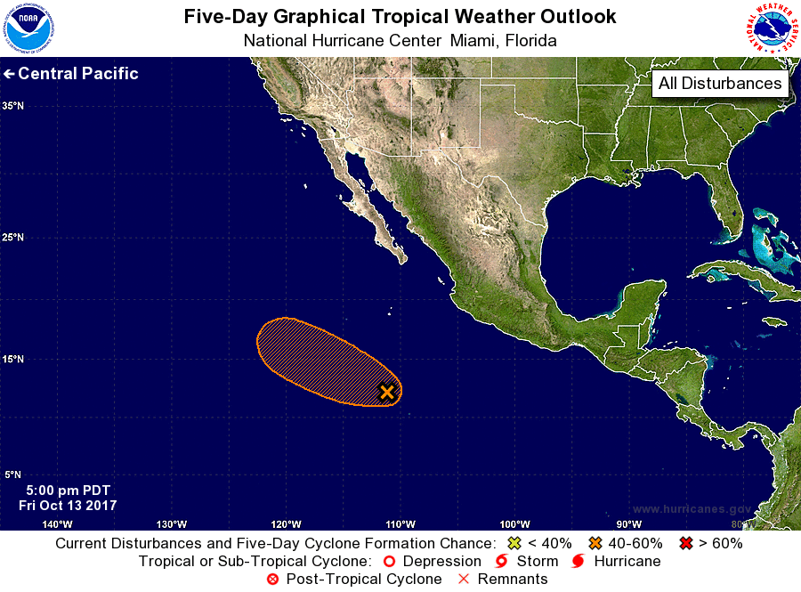
For the eastern North Pacific...east of 140 degrees west longitude:

1. Showers and thunderstorms are showing signs of organization in
association with a low pressure area centered about 800 miles south
of the southern tip of the Baja California peninsula.  Some
additional development of this system is likely, and a tropical
depression could form over the next day or two while it moves toward
the west-northwest at 10 to 15 mph. By late Monday, upper-level
winds look less favorable for development.
* Formation chance through 48 hours...medium...50 percent.
* Formation chance through 5 days...medium...60 percent.

Forecaster Blake


List of Atlantic Outlooks (May 2023 - present)
List of East Pacific Outlooks (May 2023 - present)
List of Central Pacific Outlooks (May 2023 - present)
List of Atlantic Outlooks (July 2014 - April 2023)
List of East Pacific Outlooks (July 2014 - April 2023)
List of Central Pacific Outlooks (June 2019 - April 2023)
List of Atlantic Outlooks (June 2009 - June 2014)
List of East Pacific Outlooks (June 2009 - June 2014)