ZCZC MIATWOEP ALL
TTAA00 KNHC DDHHMM
Tropical Weather Outlook
NWS National Hurricane Center Miami FL
1100 PM PDT Thu Sep 21 2017
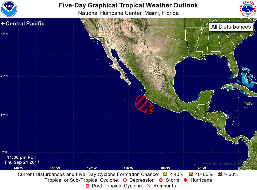
For the eastern North Pacific...east of 140 degrees west longitude:
1. Shower and thunderstorm activity associated with a low pressure
system near the southwest coast of Mexico continues to show signs of
organization. Environmental conditions are expected to be favorable
for additional development, and a tropical depression is likely to
form during the next couple of days as the system moves slowly
northwestward near the coast. Regardless of tropical cyclone
formation, heavy rains are expected over portions of southwestern
Mexico during the next several days.
* Formation chance through 48 hours...high...80 percent.
* Formation chance through 5 days...high...90 percent.
Forecaster Zelinsky