ZCZC MIATWOEP ALL
TTAA00 KNHC DDHHMM
Tropical Weather Outlook
NWS National Hurricane Center Miami FL
500 AM PDT Mon Sep 18 2017
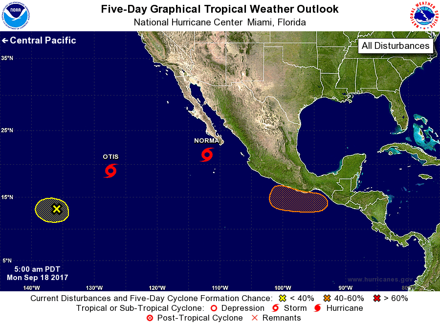
For the eastern North Pacific...east of 140 degrees west longitude:
The National Hurricane Center is issuing advisories on Tropical
Storm Norma, located southwest of the southern tip of the Baja
California peninsula, and on Hurricane Otis, located more than 1000
miles west-southwest of the southern tip of the Baja California
peninsula.
1. A trough of low pressure located about 1300 miles east-southeast of
the Hawaiian Islands is producing disorganized cloudiness and
showers. Significant development of this system is not expected
while it drifts southwestward during the next few days.
* Formation chance through 48 hours...low...10 percent.
* Formation chance through 5 days...low...10 percent.
2. An area of low pressure is expected to form by the end of the week
south of southeastern Mexico. Some subsequent development
is possible while the system moves slowly west-northwestward just
off the coast of Mexico.
* Formation chance through 48 hours...low...near 0 percent.
* Formation chance through 5 days...medium...40 percent.
Forecaster Cangialosi