ZCZC MIATWOEP ALL
TTAA00 KNHC DDHHMM
Tropical Weather Outlook
NWS National Hurricane Center Miami FL
500 AM PDT Thu Sep 14 2017
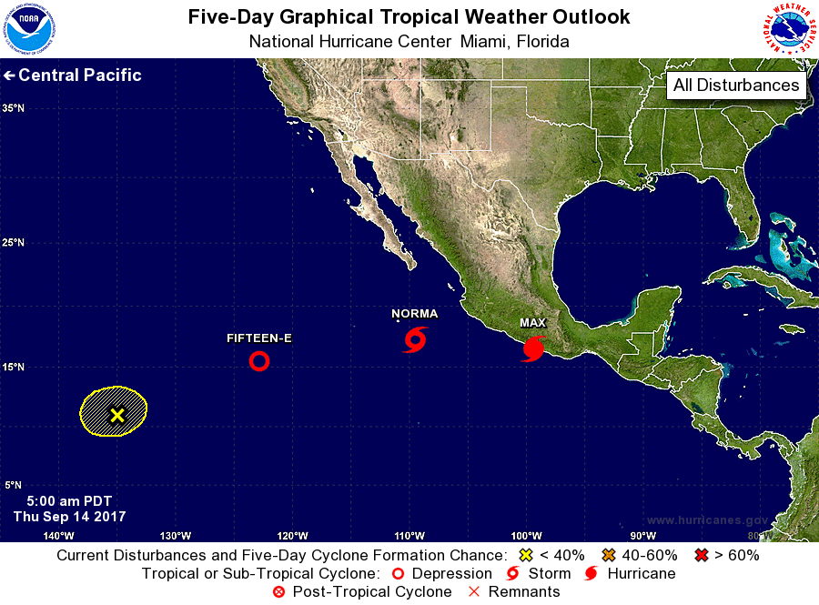
For the eastern North Pacific...east of 140 degrees west longitude:
The National Hurricane Center is issuing advisories on recently
upgraded Hurricane Max, located near the southwestern coast of
Mexico, and on Tropical Depression Fifteen-E, located about a
thousand miles west-southwest of the southern tip of the Baja
California peninsula.
1. Showers and thunderstorms associated with a low pressure system
located about 400 miles south of the southern tip of the Baja
California peninsula continue to show signs of organization, and it
appears that a tropical depression could be forming. If these
trends continue, advisories will likely be initiated on this system
later today. The low is expected to drift northward during the next
couple of days, and interests in the southern portion of Baja
California Sur should monitor the progress of this system. For more
information on this system, please see High Seas Forecasts issued by
the National Weather Service.
* Formation chance through 48 hours...high...near 100 percent.
* Formation chance through 5 days...high...near 100 percent.
2. An area of low pressure located about 1500 miles east-southeast of
the Hawaiian Islands is producing persistent but disorganized shower
and thunderstorm activity. Satellite imagery indicates that a
well-defined center does not currently exist, and additional
development, if any, is expected to be slow to occur while this
system moves little during the next several days.
* Formation chance through 48 hours...low...10 percent.
* Formation chance through 5 days...low...20 percent.
High Seas Forecasts issued by the National Weather Service can be
found under AWIPS header NFDHSFEPI, WMO header FZPN02 KWBC, and on
the web at http://www.opc.ncep.noaa.gov/shtml/NFDHSFEPI.shtml.
Public Advisories on Max are issued under WMO header WTPZ31 KNHC
and under AWIPS header MIATCPEP1.
Forecast/Advisories on Max are issued under WMO header WTPZ21 KNHC
and under AWIPS header MIATCMEP1.
Forecaster Berg