ZCZC MIATWOEP ALL
TTAA00 KNHC DDHHMM
Tropical Weather Outlook
NWS National Hurricane Center Miami FL
500 AM PDT Mon Sep 11 2017
For the eastern North Pacific...east of 140 degrees west longitude:
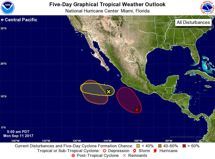
1. The remnants of Katia located about 350 miles west-southwest of
Manzanillo, Mexico are associated with a low pressure center with
numerous showers and thunderstorms. Strong upper-level winds should
limit development of this system while it moves westward at 10 to 15
mph during the next couple of days.
* Formation chance through 48 hours...low...30 percent.
* Formation chance through 5 days...low...30 percent.
2. A trough of low pressure located a few hundred miles south of the
southern coast of Mexico is producing disorganized showers and
thunderstorms. Environmental conditions are expected to be
conducive for development, and a tropical depression is likely to
form later this week while the system moves slowly northwestward.
* Formation chance through 48 hours...low...20 percent.
* Formation chance through 5 days...high...70 percent.
3. Another area of low pressure is expected to form several hundred
miles south-southwest of the Baja California peninsula by the middle
of the week. Environmental conditions are expected to be conducive
for gradual development after that time while it moves northward or
northwestward.
* Formation chance through 48 hours...low...near 0 percent.
* Formation chance through 5 days...medium...60 percent.
Forecaster Landsea