ZCZC MIATWOEP ALL
TTAA00 KNHC DDHHMM
Tropical Weather Outlook
NWS National Hurricane Center Miami FL
500 PM PDT Sat Sep 9 2017
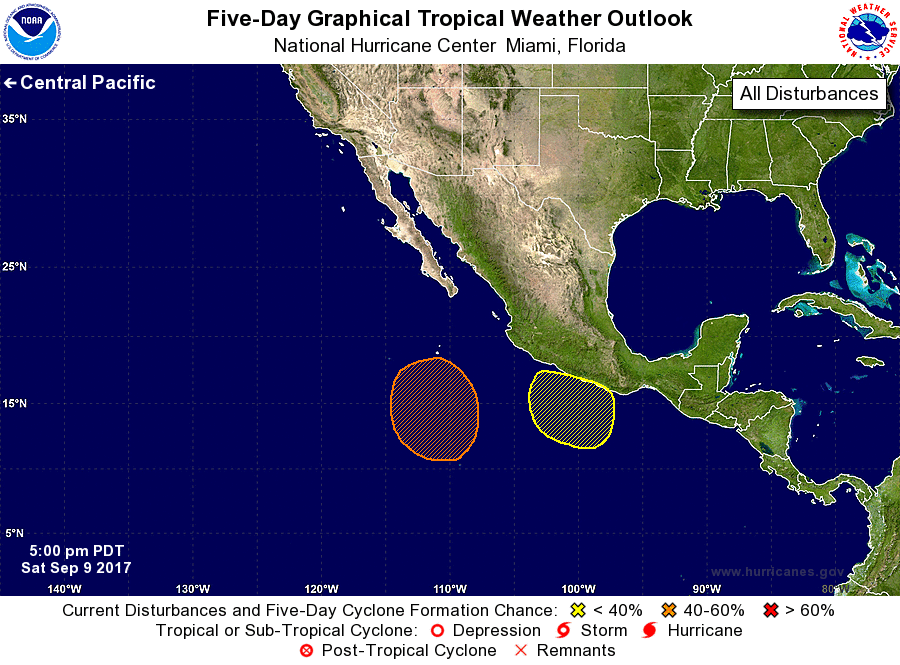
For the eastern North Pacific...east of 140 degrees west longitude:
1. An area of low pressure is expected to form well south of the Baja
California peninsula by the middle of next week. Environmental
conditions are expected to be favorable for gradual development
after that time.
* Formation chance through 48 hours...low...0 percent.
* Formation chance through 5 days...medium...50 percent.
2. Another area of low pressure may form a few hundred miles south of
southern Mexico in a few days. Environmental conditions appear to
be marginally conducive for some further development by the middle
of next week.
* Formation chance through 48 hours...low...0 percent.
* Formation chance through 5 days...low...20 percent.
Forecaster Landsea/Ramos