ZCZC MIATWOEP ALL
TTAA00 KNHC DDHHMM
Tropical Weather Outlook
NWS National Hurricane Center Miami FL
1100 AM PDT Tue Aug 29 2017
For the eastern North Pacific...east of 140 degrees west longitude:
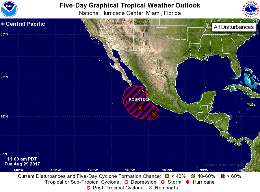
1. An elongated area of low pressure centered a few hundred miles
south of Manzanillo, Mexico, is producing a rather large area of
showers and thunderstorms near the coast of Mexico extending
southwestward for several hundred miles. This system is expected to
become a tropical cyclone on Wednesday or Thursday while it moves
generally northwestward near the coast of southwestern Mexico and
Baja California Sur. Residents along the coasts of Colima, Jalisco,
Nayarit, and Baja California Sur should monitor the progress of this
system, and tropical storm or hurricane watches or warnings could be
required for a portion of these areas later today. Very heavy rain
is also expected over the next few days in these same areas, which
could cause life-threatening flash floods and mudslides.
* Formation chance through 48 hours...high...90 percent.
* Formation chance through 5 days...high...90 percent.
Forecaster Blake