ZCZC MIATWOEP ALL
TTAA00 KNHC DDHHMM
Tropical Weather Outlook
NWS National Hurricane Center Miami FL
1100 PM PDT Thu Aug 17 2017
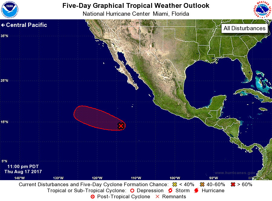
For the eastern North Pacific...east of 140 degrees west longitude:
1. Satellite images indicate that shower and thunderstorm activity
associated with a low pressure area located about 650 miles
south-southwest of the Baja California peninsula has increased
since yesterday. Environmental conditions are conducive for this
this system becoming a tropical cyclone at any time over the next
day or so while it moves west-northwestward at about 15 mph.
* Formation chance through 48 hours...high...90 percent.
* Formation chance through 5 days...high...90 percent.
Forecaster Blake