ZCZC MIATWOEP ALL
TTAA00 KNHC DDHHMM
Tropical Weather Outlook
NWS National Hurricane Center Miami FL
1100 AM PDT Tue Aug 15 2017
For the eastern North Pacific...east of 140 degrees west longitude:
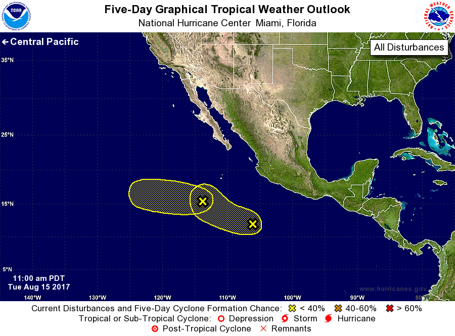
1. A broad area of low pressure is producing disorganized showers and
thunderstorms several hundred miles south-southwest of the
southern tip of the Baja California peninsula. Due to the broad
nature of the disturbance, development, if any, is expected to be
slow to occur while it moves slowly westward for the next few days.
* Formation chance through 48 hours...low...near 0 percent.
* Formation chance through 5 days...low...10 percent.
2. A westward-moving trough of low pressure located several hundred
miles southwest of Acapulco, Mexico, is producing very limited
shower and thunderstorm activity. Environmental conditions are not
forecast to support significant development of this system during
the next several days.
* Formation chance through 48 hours...low...near 0 percent.
* Formation chance through 5 days...low...10 percent.
Forecaster Zelinsky