ZCZC MIATWOEP ALL
TTAA00 KNHC DDHHMM
Tropical Weather Outlook
NWS National Hurricane Center Miami FL
1100 AM PDT Mon Aug 14 2017
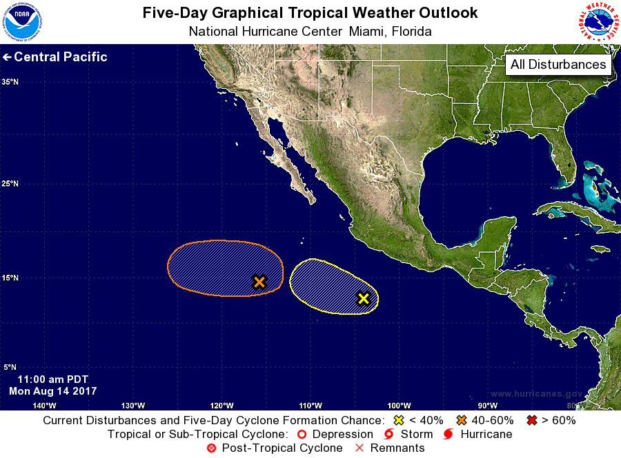
For the eastern North Pacific...east of 140 degrees west longitude:
1. A large area of disturbed weather is located several hundred miles
southwest of the southern tip of the Baja California peninsula.
Environmental conditions are expected to allow the system to
gradually consolidate over the next day or two. Some development is
possible after that time while the system moves slowly westward.
* Formation chance through 48 hours...low...10 percent.
* Formation chance through 5 days...medium...40 percent.
2. Showers and thunderstorms associated with a trough of low pressure
located several hundred miles southwest of Acapulco, Mexico, have
not become any better organized. Some slow development is possible
while the system continues moving slowly westward or
west-northwestward through a marginally conducive environment.
* Formation chance through 48 hours...low...near 0 percent.
* Formation chance through 5 days...low...30 percent.
Forecaster Zelinsky