ZCZC MIATWOEP ALL
TTAA00 KNHC DDHHMM
Tropical Weather Outlook
NWS National Hurricane Center Miami FL
1100 AM PDT Fri Aug 11 2017
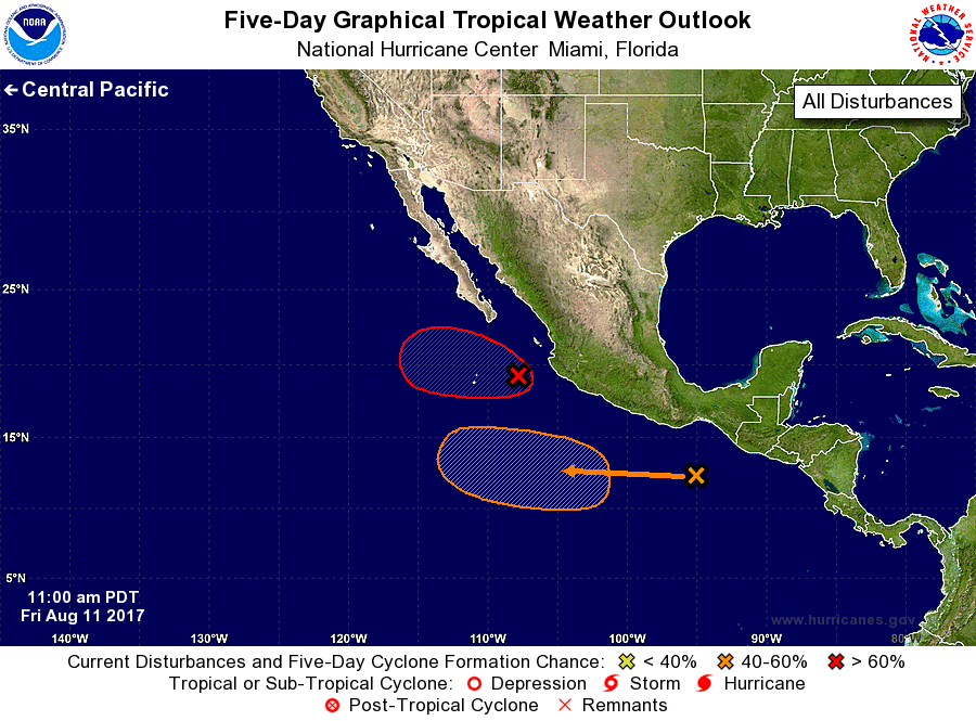
For the eastern North Pacific...east of 140 degrees west longitude:
1. Showers and thunderstorms continue to gradually become better
organized in association with an area of low pressure located about
170 miles west of Manzanillo, Mexico. If this development
trend continues, advisories will be initiated this afternoon or
tonight. The low is forecast to move west-northwestward at 10 to
15 mph, well west of the coast of Mexico.
* Formation chance through 48 hours...high...90 percent.
* Formation chance through 5 days...high...90 percent.
2. An area of low pressure is forecast to form well south of the coast
of southern Mexico during the next couple of days. Environmental
conditions are expected to be conducive for some slow development of
this system as it moves west-northwestward at 10 to 15 mph.
* Formation chance through 48 hours...low...10 percent.
* Formation chance through 5 days...medium...50 percent.
Forecaster Roberts