ZCZC MIATWOEP ALL
TTAA00 KNHC DDHHMM
Tropical Weather Outlook
NWS National Hurricane Center Miami FL
1100 PM PDT Wed Aug 9 2017
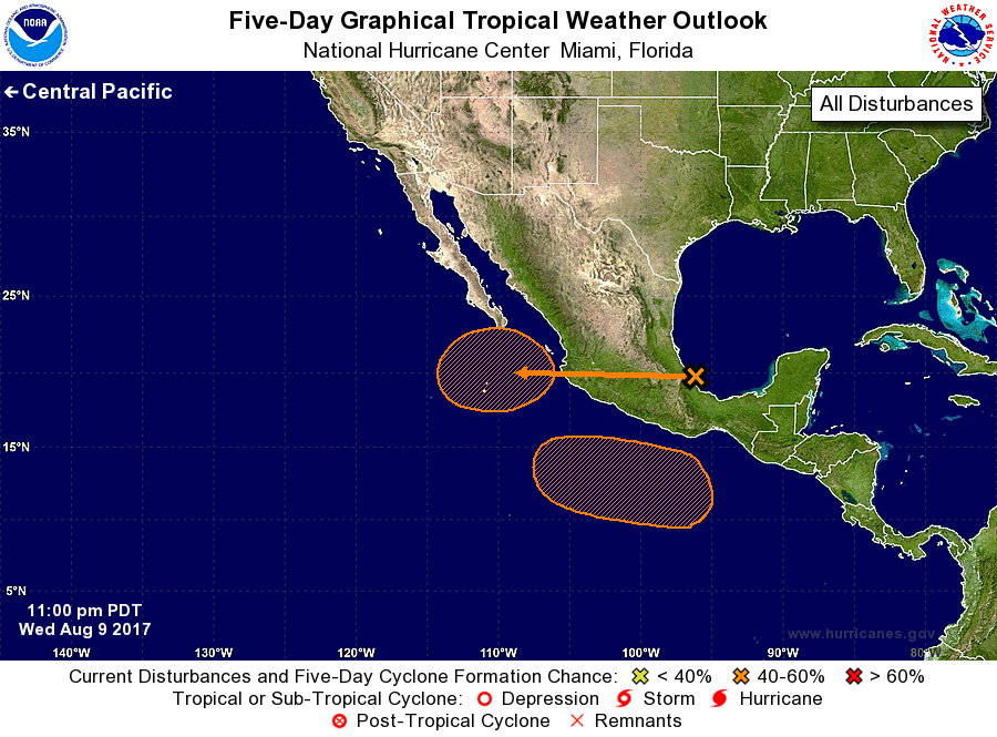
For the eastern North Pacific...east of 140 degrees west longitude:
1. An area of low pressure is expected to form just off the
west-central coast of Mexico late this week in association with the
remnants of Atlantic Hurricane Franklin after it moves across
southern Mexico. Some development of this system may occur this
weekend before it moves west-northwestward into a hostile
environment.
* Formation chance through 48 hours...low...20 percent.
* Formation chance through 5 days...medium...40 percent.
2. Another area of low pressure is forecast to form well south of the
coast of southern Mexico this weekend. Environmental conditions are
expected to be conducive for some gradual development of this system
early next week.
* Formation chance through 48 hours...low...near 0 percent.
* Formation chance through 5 days...medium...40 percent.
Forecaster Landsea