ZCZC MIATWOEP ALL
TTAA00 KNHC DDHHMM
Tropical Weather Outlook
NWS National Hurricane Center Miami FL
500 AM PDT Fri Aug 4 2017
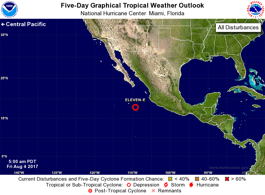
For the eastern North Pacific...east of 140 degrees west longitude:
1. An area of low pressure located a few hundred miles west-southwest
of Manzanillo, Mexico, is moving west-northwestward at 15 to 20
mph. Although the environment is only moderately supportive of
development, the system appears to be developing a low-level
circulation, and only a small increase in the organization of
showers and thunderstorms would result in the formation of a
tropical depression. After about 24 hours, the environment is
forecast to become less favorable which should cause the low
pressure system to dissipate within a few days.
* Formation chance through 48 hours...high...80 percent.
* Formation chance through 5 days...high...80 percent.
Forecaster Zelinsky