ZCZC MIATWOEP ALL
TTAA00 KNHC DDHHMM
Tropical Weather Outlook
NWS National Hurricane Center Miami FL
1100 PM PDT Mon Jul 31 2017
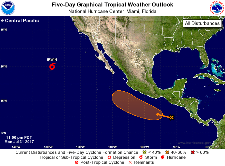
For the eastern North Pacific...east of 140 degrees west longitude:
The National Hurricane Center is issuing advisories on Tropical
Storm Irwin, located more than a thousand miles west of the southern
tip of the Baja California peninsula.
1. Disorganized cloudiness and thunderstorms located several hundred
miles south-southeast of the Gulf of Tehuantepec are associated
with a tropical wave. Environmental conditions appear conducive
for some slow development of this disturbance during the next
several days while it moves west-northwestward at 10 to 15 mph
south of the coast of Mexico. Upper-level winds will likely become
unfavorable for development by Friday.
* Formation chance through 48 hours...low...20 percent.
* Formation chance through 5 days...medium...40 percent.
Forecaster Brown