ZCZC MIATWOEP ALL
TTAA00 KNHC DDHHMM
Tropical Weather Outlook
NWS National Hurricane Center Miami FL
1100 PM PDT Wed Jul 26 2017
For the eastern North Pacific...east of 140 degrees west longitude:
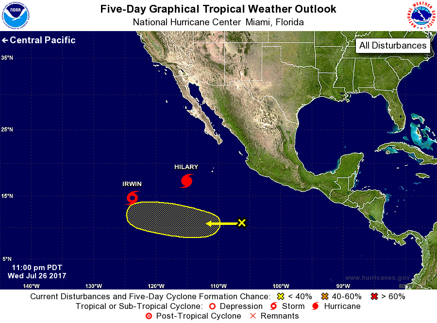
The National Hurricane Center is issuing advisories on Hurricane
Hilary, located several hundred miles southwest of the southern tip
of the Baja California peninsula, and on Tropical Storm Irwin,
located about 1000 miles west-southwest of the southern tip
of the Baja California peninsula.
1. A tropical wave, located several hundred miles south of Manzanillo,
Mexico, is producing limited shower and thunderstorm activity.
Significant development is not anticipated during the next few days
due to strong upper-level winds produced by Hurricane Hilary.
Upper-level winds, however, could become more conducive for some
development this weekend as Hilary weakens and moves farther away
from the tropical wave. The system is expected to move
west-northwestward at 5 to 10 mph during the next several days.
* Formation chance through 48 hours...low...near 0 percent.
* Formation chance through 5 days...low...20 percent.
Forecaster Roberts