ZCZC MIATWOEP ALL
TTAA00 KNHC DDHHMM
Tropical Weather Outlook
NWS National Hurricane Center Miami FL
1100 AM PDT Wed Jul 26 2017
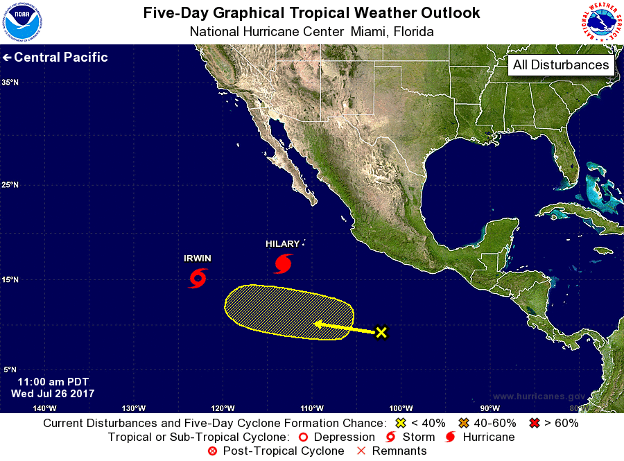
For the eastern North Pacific...east of 140 degrees west longitude:
The National Hurricane Center is issuing advisories on Hurricane
Hilary, located several hundred miles south-south of southern tip of
the Baja California peninsula, and on Tropical Storm Irwin, located
several hundred miles west-southwest of the southern tip of the Baja
California peninsula.
1. Disorganized cloudiness and showers centered several hundred miles
south of Acapulco Mexico are associated with a tropical wave.
Development, if any, of this system is expected to be slow to occur
during the next few days due to strong upper-level winds. These
winds might become more conducive for some development this weekend
as Hurricane Hilary moves farther away from the disturbance. This
system is expected to move west-northwestward at 5 to 10 mph during
the next several days.
* Formation chance through 48 hours...low...near 0 percent.
* Formation chance through 5 days...low...20 percent.
Forecaster Blake