ZCZC MIATWOEP ALL
TTAA00 KNHC DDHHMM
Tropical Weather Outlook
NWS National Hurricane Center Miami FL
500 PM PDT Mon Jul 24 2017
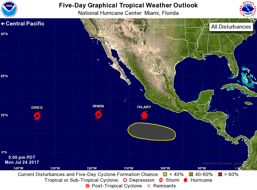
For the eastern North Pacific...east of 140 degrees west longitude:
The National Hurricane Center is issuing advisories on Tropical
Storm Greg, located more than 1000 miles east of the Big Island of
Hawaii, on Hurricane Hilary, located a few hundred miles south of
Manzanillo, Mexico, and on Tropical Storm Irwin, located several
hundred miles southwest of the southern tip of the Baja California
peninsula.
1. An area of low pressure could form several hundred miles south of
Mexico in a couple of days. Development, if any, of this system is
expected to be slow to occur due to strong upper-level winds
associated with Hurricane Hilary. The system is forecast to move
west-northwestward at 5 to 10 mph for the next several days.
* Formation chance through 48 hours...low...near 0 percent.
* Formation chance through 5 days...low...20 percent.
Forecaster Cangialosi