ZCZC MIATWOEP ALL
TTAA00 KNHC DDHHMM
Tropical Weather Outlook
NWS National Hurricane Center Miami FL
1100 AM PDT Tue Jul 18 2017
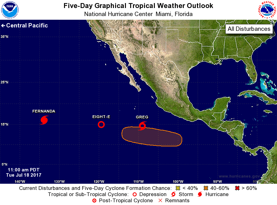
For the eastern North Pacific...east of 140 degrees west longitude:
The National Hurricane Center is issuing advisories on Hurricane
Fernanda located well to the east of Hilo, Hawaii, and on Tropical
Storm Greg located a few hundred miles southwest of Manzanillo,
Mexico, and on newly formed Tropical Depression Eight-E located
several hundred miles southwest of the southern tip of the Baja
California peninsula.
1. An area of low pressure is expected to form in the eastern
Pacific Ocean south of Mexico late this week. Environmental
conditions appear conducive for development of the system this
the weekend while it moves westward to west-northwestward at 10 to
15 mph.
* Formation chance through 48 hours...low...near 0 percent.
* Formation chance through 5 days...medium...50 percent.
Public Advisories on Tropical Depression Eight-E are issued under
WMO header WTPZ33 KNHC and under AWIPS header MIATCPEP3.
Forecast/Advisories on Tropical Depression Eight-E are issued under
WMO header WTPZ23 KNHC and under AWIPS header MIATCMEP3.
Forecaster Landsea