ZCZC MIATWOEP ALL
TTAA00 KNHC DDHHMM
Tropical Weather Outlook
NWS National Hurricane Center Miami FL
1100 PM PDT Fri Jul 14 2017
For the eastern North Pacific...east of 140 degrees west longitude:
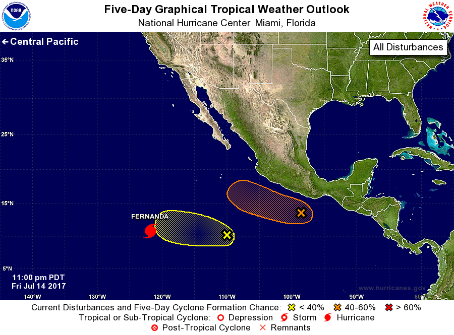
The National Hurricane Center is issuing advisories on Hurricane
Fernanda, located well to the southwest of the southern tip of the
Baja California peninsula.
1. A broad low pressure system centered a few hundred miles southwest
of the Gulf of Tehuantepec is producing disorganized showers and
thunderstorms. Environmental conditions are forecast to be somewhat
conducive for gradual development, and a tropical depression could
form by early next week while the system moves slowly toward the
west-northwest at 5 to 10 mph.
* Formation chance through 48 hours...low...30 percent.
* Formation chance through 5 days...medium...50 percent.
2. Disorganized cloudiness and showers located several hundred miles
southwest of Manzanillo, Mexico are associated with a trough of low
pressure. Development, if any, of this system is expected to be
slow to occur as the system moves west-northwestward at about 10
mph.
* Formation chance through 48 hours...low...10 percent.
* Formation chance through 5 days...low...20 percent.
Forecaster Avila