ZCZC MIATWOEP ALL
TTAA00 KNHC DDHHMM
Tropical Weather Outlook
NWS National Hurricane Center Miami FL
500 PM PDT Thu Jul 6 2017
For the eastern North Pacific...east of 140 degrees west longitude:
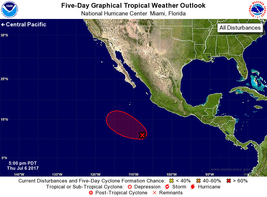
1. Satellite images indicate that showers and thunderstorms
associated with an area of low pressure located about 800 miles
south of the southern tip of the Baja California peninsula have
continued to gradually become better organized today. Conditions are
expected to be favorable for additional development, and this system
is likely to become a tropical depression during the next day or so
while it moves west-northwestward or northwestward at about 10 mph.
* Formation chance through 48 hours...high...80 percent.
* Formation chance through 5 days...high...90 percent.
Forecaster Brown