ZCZC MIATWOEP ALL
TTAA00 KNHC DDHHMM
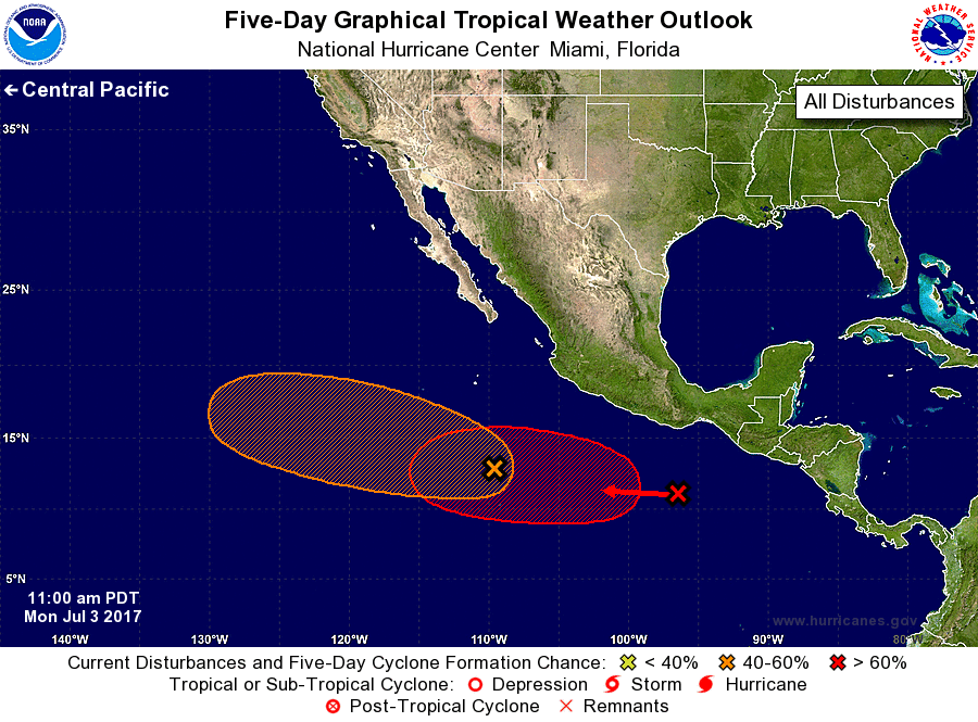
Tropical Weather Outlook
NWS National Hurricane Center Miami FL
1100 AM PDT Mon Jul 3 2017
For the eastern North Pacific...east of 140 degrees west longitude:
1. A broad area of low pressure is located about 650 miles south of
the southern tip of the Baja California peninsula. Showers and
thunderstorms associated with the disturbance have increased in
coverage since yesterday, but the circulation remains elongated.
Additional development of this system is possible and a tropical
depression could form during the next several days while it
moves west-northwestward.
* Formation chance through 48 hours...medium...40 percent.
* Formation chance through 5 days...medium...60 percent.
2. A tropical wave located south-southwest of the Gulf of Tehuantepec
is producing disorganized showers and thunderstorms. A low pressure
system is expected to form well south of the coast of Mexico in
association with the wave during the next day or two. Environmental
conditions are forecast to be favorable for development and a
tropical depression is likely to form later this week while the
system moves westward at about 10 mph.
* Formation chance through 48 hours...low...near 0 percent.
* Formation chance through 5 days...high...70 percent.
Forecaster Brown