ZCZC MIATWOEP ALL
TTAA00 KNHC DDHHMM
Tropical Weather Outlook
NWS National Hurricane Center Miami FL
1100 AM PDT Sun Jun 11 2017
For the eastern North Pacific...east of 140 degrees west longitude:
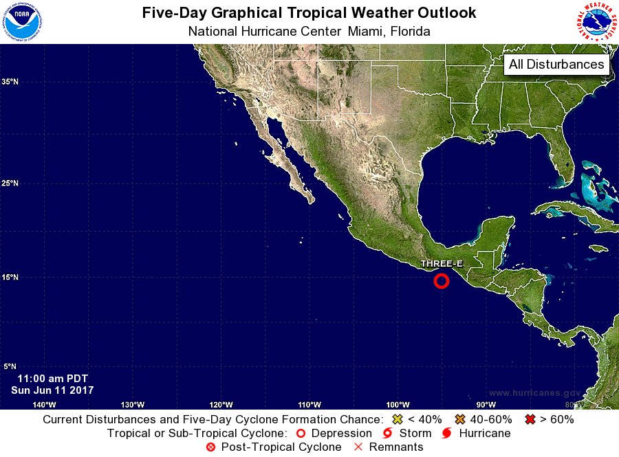
1. Satellite wind data indicate that an area of low pressure located
about 150 miles south-southeast of Salina Cruz, Mexico, has become
better defined today. The system is likely to become a tropical
depression later today while it moves slowly west-northwestward or
northwestward toward the coast of Mexico. Interests in
southeastern Mexico should monitor the progress of this system.
Heavy rains should continue to spread across Guatemala and
southeastern Mexico during the next few days, which could result
in flash floods and mud slides.
* Formation chance through 48 hours...high...90 percent.
* Formation chance through 5 days...high...90 percent.
Forecaster Cangialosi/Pasch