ZCZC MIATWOEP ALL
TTAA00 KNHC DDHHMM
Tropical Weather Outlook
NWS National Hurricane Center Miami FL
500 AM PDT Sun Jun 11 2017
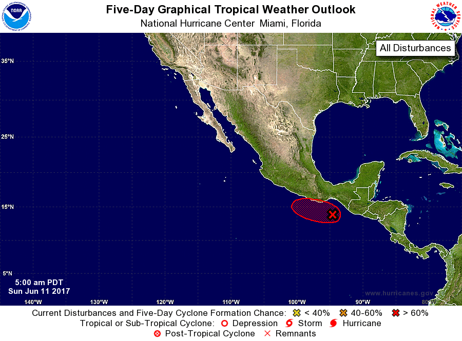
For the eastern North Pacific...east of 140 degrees west longitude:
1. Showers and thunderstorms continue to become better organized in
association with an area of low pressure located a couple of
hundred miles south-southeast of Salina Cruz, Mexico. Additional
development is possible during the next day or two and this system
could become a tropical depression while it moves slowly
west-northwestward to northwestward toward the coast of southern
Mexico. Regardless of development, locally heavy rains are expected
to spread over the coasts of El Salvador, Guatemala, and
southeastern Mexico during the next few days.
* Formation chance through 48 hours...medium...60 percent.
* Formation chance through 5 days...high...70 percent.
Forecaster Cangialosi/Pasch