ZCZC MIATWOEP ALL
TTAA00 KNHC DDHHMM
Tropical Weather Outlook
NWS National Hurricane Center Miami FL
500 AM PDT Tue May 30 2017
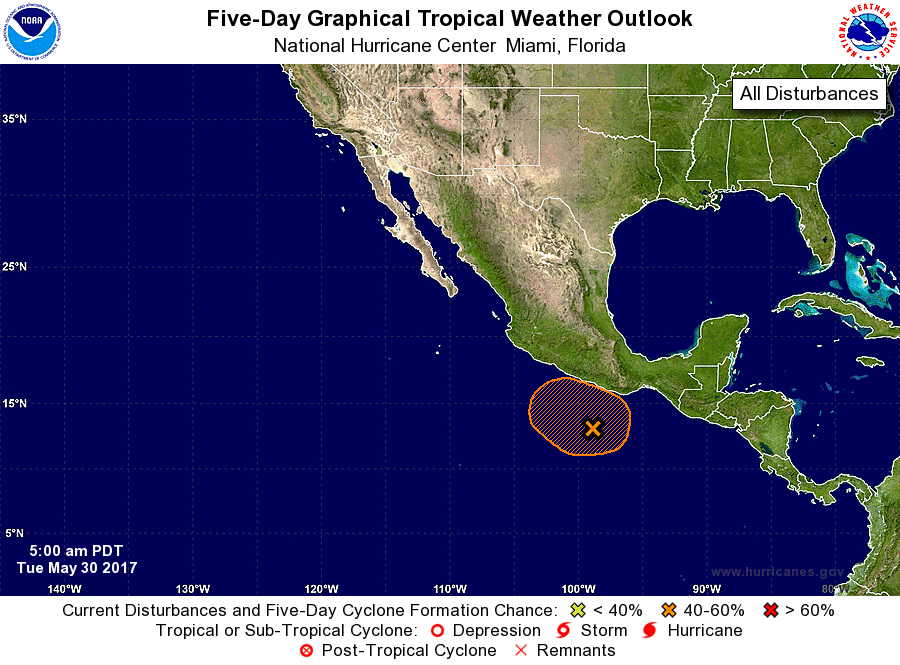
For the eastern North Pacific...east of 140 degrees west longitude:
1. Disorganized showers and thunderstorms extending from near the Gulf
of Tehuantepec southwestward for several hundred miles are
associated with a broad area of low pressure. Environmental
conditions are expected to be conducive for gradual development
of this disturbance during the next several days while it
drifts generally northward. Regardless of development, locally
heavy rains may spread onto the coast of southeastern and southern
Mexico during the next several days.
* Formation chance through 48 hours...low...30 percent.
* Formation chance through 5 days...medium...60 percent.
Forecaster Beven