Skip Navigation Links
NOAA NOAA United States Department of Commerce

NHC Graphical Outlook Archive


« Earliest Available         ‹ Earlier         Later ›         Latest Available »
GIS Shapefiles
tab Eastern North Pacific tab tab Atlantic tab

View 2-Day Graphical Tropical Weather Outlook
Click for Atlantic Click for Atlantic

Tropical Weather Outlook Text

ZCZC MIATWOEP ALL
TTAA00 KNHC DDHHMM

Tropical Weather Outlook
NWS National Hurricane Center Miami FL
500 PM PDT Mon May 29 2017

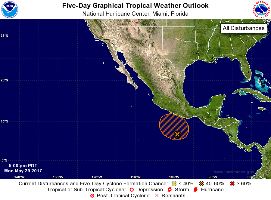
For the eastern North Pacific...east of 140 degrees west longitude:

1. A broad area of low pressure located a few hundred miles south of
Acapulco, Mexico, is producing a large area of disorganized showers
and thunderstorms that extends from near the Gulf of Tehuantepec
southwestward for several hundred miles.  Environmental conditions
are expected to be conducive for some gradual development during
the next several days while the low drifts generally northward.
* Formation chance through 48 hours...low...20 percent.
* Formation chance through 5 days...medium...60 percent.

Forecaster Brown


List of Atlantic Outlooks (May 2023 - present)
List of East Pacific Outlooks (May 2023 - present)
List of Central Pacific Outlooks (May 2023 - present)
List of Atlantic Outlooks (July 2014 - April 2023)
List of East Pacific Outlooks (July 2014 - April 2023)
List of Central Pacific Outlooks (June 2019 - April 2023)
List of Atlantic Outlooks (June 2009 - June 2014)
List of East Pacific Outlooks (June 2009 - June 2014)