ZCZC MIATWOEP ALL
TTAA00 KNHC DDHHMM
Special Tropical Weather Outlook
NWS National Hurricane Center Miami FL
1145 AM PDT Sun May 7 2017
For the eastern North Pacific...east of 140 degrees west longitude:
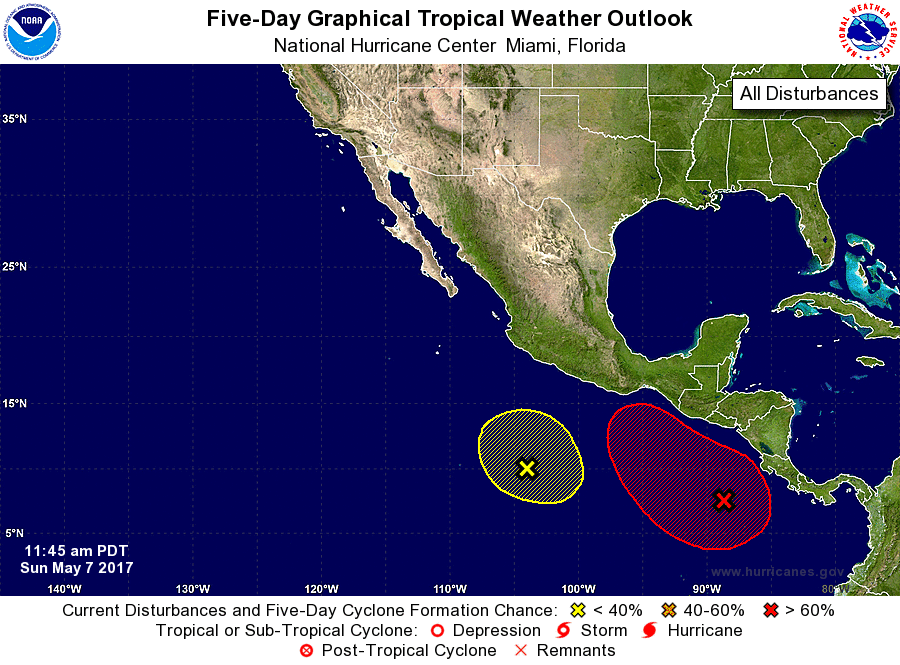
1. An area of of disturbed weather has developed in association with a
low pressure area a few hundred miles southwest of the coast of
Costa Rica. Environmental conditions are forecast to be favorable
for gradual development, and a tropical depression could form by the
middle of next week while the low moves slowly toward the northwest.
The next Special Tropical Weather Outlook will be issued by 12 PM
PDT Monday.
* Formation chance through 48 hours...low...near 20 percent.
* Formation chance through 5 days...high...70 percent.
2. A second area of disturbed weather has formed several hundred
miles south-southwest of Acapulco, Mexico. Some slow development
could occur during the next couple of days before this system is
absorbed into the above-mentioned disturbance to the east.
* Formation chance through 48 hours...low...10 percent.
* Formation chance through 5 days...low...10 percent.
Forecaster Beven
Forecaster Beven