ZCZC MIATWOEP ALL
TTAA00 KNHC DDHHMM
TROPICAL WEATHER OUTLOOK
NWS NATIONAL HURRICANE CENTER MIAMI FL
400 PM PST SAT NOV 12 2016
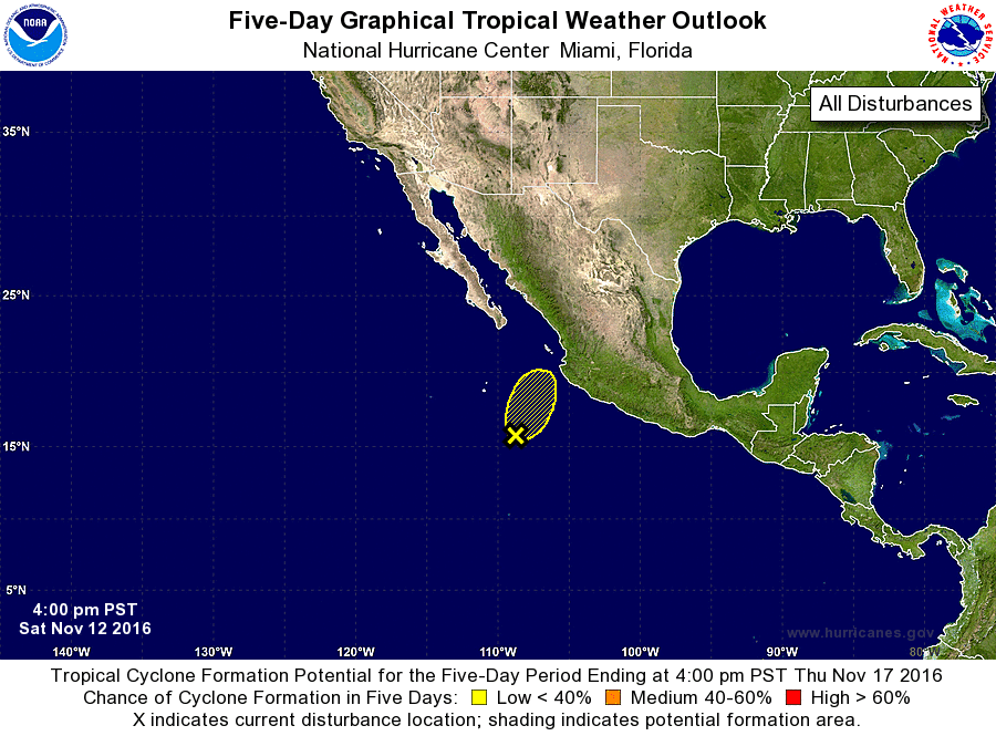
For the eastern North Pacific...east of 140 degrees west longitude:
1. Shower and thunderstorm activity has become more concentrated and
better organized since yesterday in association with an area of low
pressure located about 350 miles southwest of Manzanillo, Mexico.
However, satellite data suggest that the low's circulation is still
not particularly well defined. Strong upper-level winds over the
low are only expected to become stronger by tonight and Sunday,
making the potential for tropical cyclone formation unlikely.
Regardless, locally heavy rainfall associated with this system could
occur over portions of southwestern and central Mexico during the
next day or two.
* Formation chance through 48 hours...low...10 percent
* Formation chance through 5 days...low...10 percent
Forecaster Kimberlain