ZCZC MIATWOEP ALL
TTAA00 KNHC DDHHMM
TROPICAL WEATHER OUTLOOK
NWS NATIONAL HURRICANE CENTER MIAMI FL
1100 AM PDT TUE OCT 18 2016
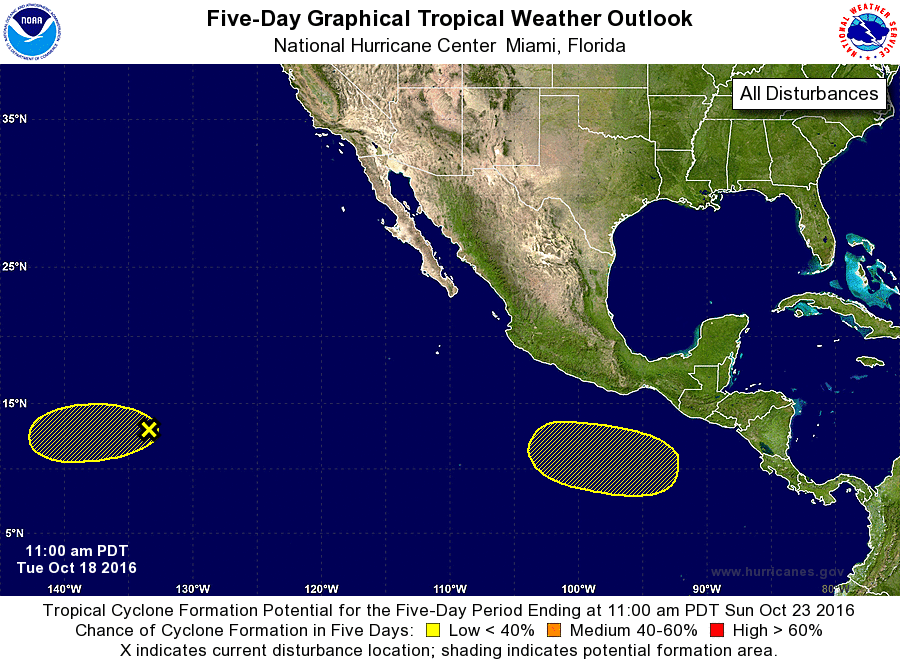
For the eastern North Pacific...east of 140 degrees west longitude:
1. A low pressure system located about 1700 miles west-southwest of
the southern tip of the Baja California peninsula continues to
produce disorganized showers and thunderstorms. Development, if
any, of this system is expected to be slow to occur during the
next couple of days before environmental conditions become less
conducive. The low is forecast to move west-southwestward at about
10 mph during the next few days.
* Formation chance through 48 hours...low...20 percent
* Formation chance through 5 days...low...20 percent
2. An area of low pressure is expected to form in a few days well to
the south of the Gulf of Tehuantepec. Some gradual development of
this disturbance is possible over the weekend while the system moves
to the west-northwest at about 10 to 15 mph.
* Formation chance through 48 hours...low...near 0 percent
* Formation chance through 5 days...low...20 percent
Forecaster Blake