ZCZC MIATWOEP ALL
TTAA00 KNHC DDHHMM
TROPICAL WEATHER OUTLOOK
NWS NATIONAL HURRICANE CENTER MIAMI FL
1100 PM PDT TUE OCT 11 2016
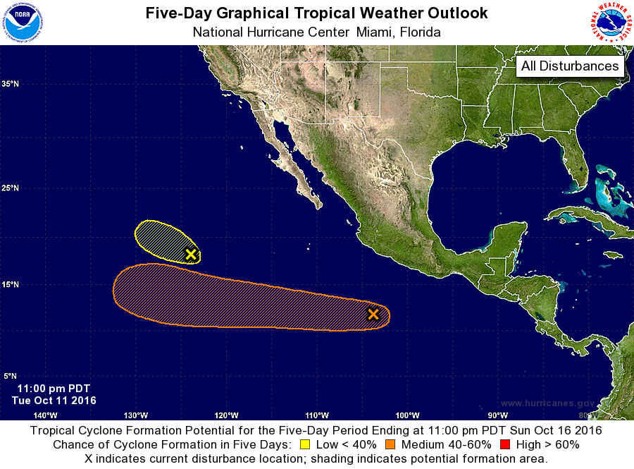
For the eastern North Pacific...east of 140 degrees west longitude:
1. Showers activity associated with a low pressure area located about
1000 miles west-southwest of the southern tip of the Baja California
peninsula is limited. The low is moving northwestward toward cooler
waters, and tropical cyclone formation is becoming less likely to
occur.
* Formation chance through 48 hours...low...20 percent
* Formation chance through 5 days...low...20 percent
2. A weak area of low pressure located several hundred miles south of
Manzanillo, Mexico, is producing disorganized showers and
thunderstorms. Environmental conditions are conducive for slow
development of this system during the next several days while the
low moves westward away from Mexico.
* Formation chance through 48 hours...low...20 percent
* Formation chance through 5 days...medium...50 percent
Forecaster Avila