ZCZC MIATWOEP ALL
TTAA00 KNHC DDHHMM
TROPICAL WEATHER OUTLOOK
NWS NATIONAL HURRICANE CENTER MIAMI FL
500 PM PDT TUE OCT 11 2016
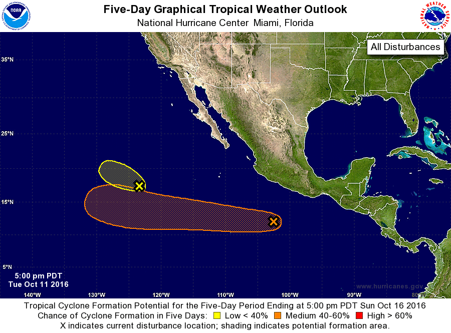
For the eastern North Pacific...east of 140 degrees west longitude:
1. Showers and thunderstorms continue near a low pressure area
centered about 1000 miles west-southwest of the southern tip of the
Baja California peninsula. Some development of this low is
possible during the next day or two before it moves west-
northwestward over cooler waters and into a region of strong
upper-level winds.
* Formation chance through 48 hours...low...30 percent
* Formation chance through 5 days...low...30 percent
2. A weak area of low pressure located several hundred miles south-
southeast of Manzanillo, Mexico, continues to produce disorganized
showers and thunderstorms. Environmental conditions are conducive
for slow development of this system during the next several days
while the low moves westward well to the southwest of mainland
Mexico.
* Formation chance through 48 hours...low...20 percent
* Formation chance through 5 days...medium...50 percent
Forecaster Cangialosi