ZCZC MIATWOEP ALL
TTAA00 KNHC DDHHMM
TROPICAL WEATHER OUTLOOK
NWS NATIONAL HURRICANE CENTER MIAMI FL
500 AM PDT TUE OCT 11 2016
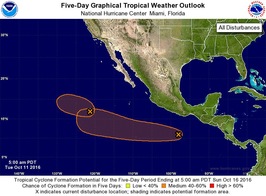
For the eastern North Pacific...east of 140 degrees west longitude:
1. Showers and thunderstorms have become a little more concentrated
near an elongated area of low pressure located about 900 miles
west-southwest of the southern tip of the Baja California
peninsula. This disturbance has the potential to become a tropical
depression before it moves west-northwestward over cooler waters in
2 or 3 days.
* Formation chance through 48 hours...low...30 percent
* Formation chance through 5 days...medium...40 percent
2. Disorganized showers and thunderstorms located a few hundred
miles south of Acapulco, Mexico, are associated with a weak low
pressure system. Environmental conditions are expected to be
generally conducive for development, and a tropical depression
could form by the weekend while the low moves westward well to the
southwest of mainland Mexico.
* Formation chance through 48 hours...low...20 percent
* Formation chance through 5 days...medium...60 percent
Forecaster Blake