ZCZC MIATWOEP ALL
TTAA00 KNHC DDHHMM
TROPICAL WEATHER OUTLOOK
NWS NATIONAL HURRICANE CENTER MIAMI FL
500 PM PDT SUN OCT 9 2016
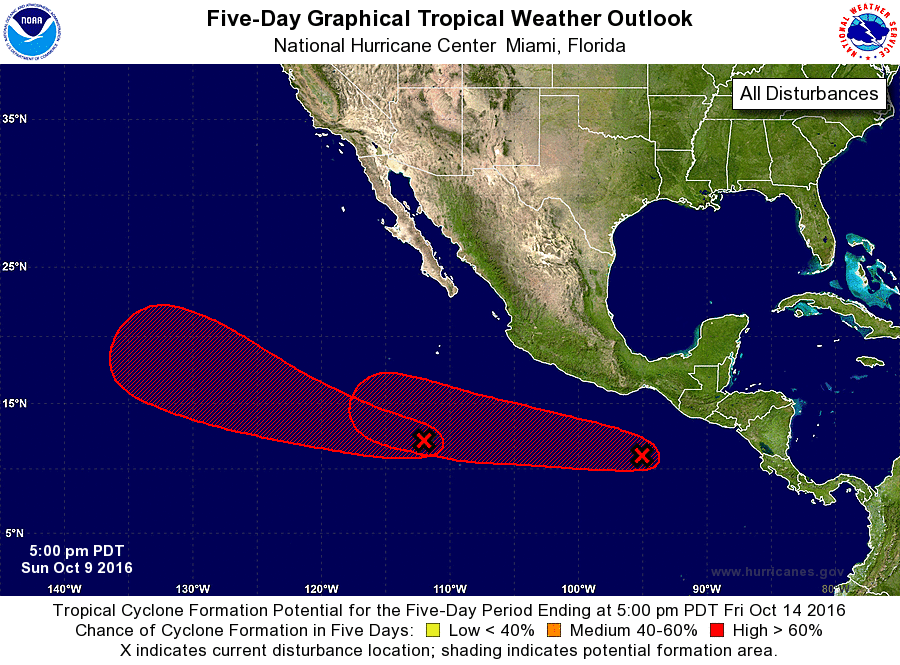
For the eastern North Pacific...east of 140 degrees west longitude:
1. A broad area of low pressure located several hundred miles south of
the southern tip of the Baja California peninsula is producing a
large area of cloudiness and showers. This disturbed weather is
expected to slowly consolidate during the next few days, and a
tropical depression is likely to form later this week while the
system moves west-northwestward to northwestward.
* Formation chance through 48 hours...low...20 percent
* Formation chance through 5 days...high...70 percent
2. Disorganized showers and thunderstorms located a few hundred miles
south of the Gulf of Tehuantepec are associated with a trough of low
pressure. Environmental conditions are expected to be conducive for
development of this system, and a tropical depression is likely to
form later this week while it moves west-northwestward.
* Formation chance through 48 hours...low...20 percent
* Formation chance through 5 days...high...70 percent
Forecaster Cangialosi