ZCZC MIATWOEP ALL
TTAA00 KNHC DDHHMM
TROPICAL WEATHER OUTLOOK
NWS NATIONAL HURRICANE CENTER MIAMI FL
500 AM PDT SAT OCT 8 2016
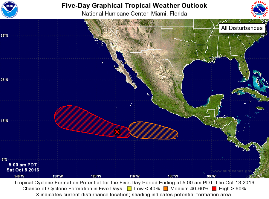
For the eastern North Pacific...east of 140 degrees west longitude:
1. A large area of disorganized showers and thunderstorms extending
from several hundred miles south through southwest of the southern
tip of the Baja California peninsula is associated with a trough of
low pressure. Environmental conditions are expected to be conducive
for gradual development of this disturbed weather, and a tropical
depression is likely to form by the early or middle part of next
week while this system moves west-northwestward.
* Formation chance through 48 hours...low...20 percent
* Formation chance through 5 days...high...70 percent
2. An area of low pressure is expected to develop several hundred miles
south or southwest of the south-central coast of Mexico by early
next week. Environmental conditions are expected to be conducive for
development while the low moves westward or west-northwestward.
* Formation chance through 48 hours...low...near 0 percent
* Formation chance through 5 days...medium...50 percent
Forecaster Kimberlain