ZCZC MIATWOEP ALL
TTAA00 KNHC DDHHMM
TROPICAL WEATHER OUTLOOK
NWS NATIONAL HURRICANE CENTER MIAMI FL
500 AM PDT TUE SEP 27 2016
For the eastern North Pacific...east of 140 degrees west longitude:
The National Hurricane Center is issuing advisories on Tropical
Storm Roslyn, located well southwest of the southern tip of the
Baja California peninsula. The Central Pacific Hurricane Center is
issuing advisories on Tropical Storm Ulika that is expected to move
northeastward into the eastern Pacific basin by Wednesday.
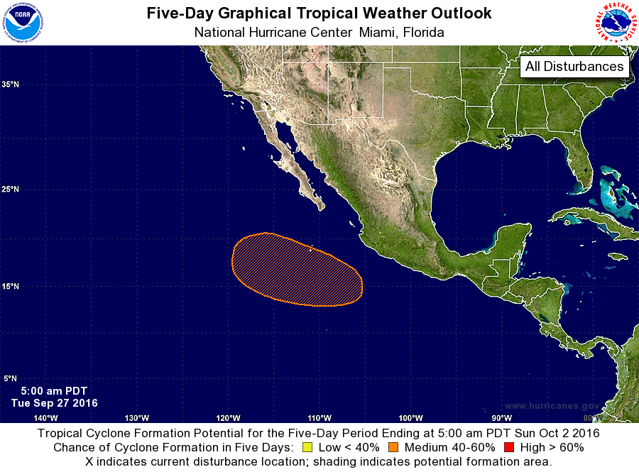
1. An area of low pressure is expected to form several hundred south
or south-southeast of the southern tip of the Baja California
peninsula in a couple of days. Environmental conditions are expected
to be conducive for gradual development of this system late this
week and this weekend while the low moves west-northwestward.
* Formation chance through 48 hours...low...near 0 percent
* Formation chance through 5 days...medium...40 percent
Public Advisories on Ulika are issued under WMO header
WTPA32 PHFO and under AWIPS header HFOTCPCP2.
Forecast/Advisories on Ulika are issued under WMO header
WTPA22 PHFO and under AWIPS header HFOTCMCP2.
Forecaster Kimberlain