ZCZC MIATWOEP ALL
TTAA00 KNHC DDHHMM
TROPICAL WEATHER OUTLOOK
NWS NATIONAL HURRICANE CENTER MIAMI FL
1100 PM PDT MON SEP 26 2016
For the eastern North Pacific...east of 140 degrees west longitude:
The National Hurricane Center is issuing advisories on Tropical
Storm Roslyn, located well southwest of the southern tip of the
Baja California peninsula.
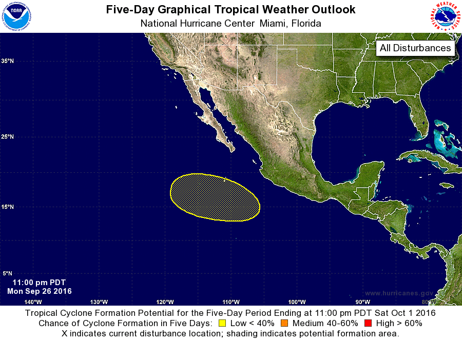
1. An area of low pressure could form well south of the southern tip
of the Baja California peninsula in a few days. Environmental
conditions are expected to be conducive for some gradual development
of this system later this week and this weekend while it moves
west-northwestward away from the coast of Mexico.
* Formation chance through 48 hours...low...near 0 percent
* Formation chance through 5 days...low...20 percent
Forecaster Berg