ZCZC MIATWOEP ALL
TTAA00 KNHC DDHHMM
TROPICAL WEATHER OUTLOOK
NWS NATIONAL HURRICANE CENTER MIAMI FL
1100 AM PDT SAT SEP 24 2016
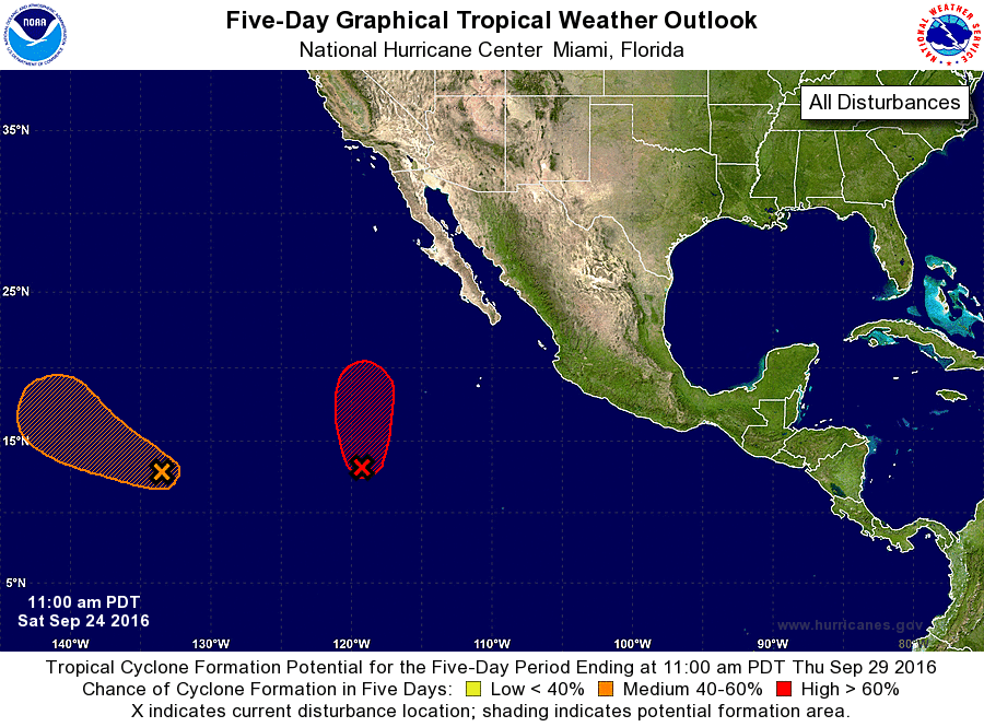
For the eastern North Pacific...east of 140 degrees west longitude:
1. Showers and thunderstorms are gradually becoming better organized in
association with a large low pressure system located about 900 miles
southwest of the southern tip of Baja California Sur. Environmental
conditions are conducive for development, and a tropical depression
will likely form later today or Sunday. This disturbance is
expected to move slowly northward during the next few days.
* Formation chance through 48 hours...high...90 percent
* Formation chance through 5 days...high...90 percent
2. An area of low pressure located about 1500 miles east-southeast of
the Big Island of Hawaii is producing disorganized showers and
thunderstorms. Environmental conditions are forecast to become more
conducive for some development of this disturbance by early next
week. This system is expected to move west-northwestward during the
next few days and then turn northward.
* Formation chance through 48 hours...low...10 percent
* Formation chance through 5 days...medium...40 percent
Forecaster Cangialosi