ZCZC MIATWOEP ALL
TTAA00 KNHC DDHHMM
TROPICAL WEATHER OUTLOOK
NWS NATIONAL HURRICANE CENTER MIAMI FL
500 PM PDT THU SEP 22 2016
For the eastern North Pacific...east of 140 degrees west longitude:
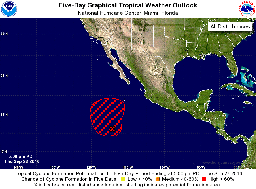
1. A broad area of low pressure is located about 900 miles
south-southwest of the southern tip of the Baja California
peninsula. Although this system continues to produce a large area of
persistent showers and thunderstorms, recent satellite data
indicates that a well-defined surface circulation has not yet
formed. Environmental conditions are still forecast to support the
development of a tropical depression within the next few days while
the disturbance moves slowly toward the northwest and then north at
about 5 to 10 mph.
* Formation chance through 48 hours...high...70 percent
* Formation chance through 5 days...high...90 percent
Forecaster Beven/Zelinsky